
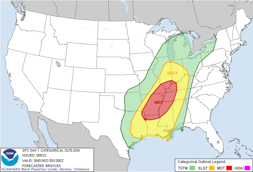
The above radar image shows prefrontal thunderstorms along the MS River, moving quickly NE. A tornado warning is in effect for parts of Bolivar County until 730 PM this evening with a severe thunderstorm warning in effect for parts of Washington County until 745 PM. These storms will certainly need to be watched vigilantly through the evening as they move into north Mississippi.

1km SRH (Storm relative helicity), or the degree to which the winds are veering in the lowest 1km of the atmosphere, are sufficiently high across northwest Mississippi to favor a few isolated tornadoes. The values are much higher back to the west where the better upper support is located at this time. However, that support and subsequent higher shear will be moving gradually eastward throughout the night, and additional prefrontal storms/possible supercells are expected across parts of central/eastern Arkansas into north/central MS and western TN through the night. Given the strong shear and increasingly moist/unstable airmass, tornadoes are possible in addition to damaging winds.
A squall line is still expected to sweep across the Lower MS Valley during the overnight hours and will be capable of producing widespread, and potentially significant, damaging winds.
IW
No comments:
Post a Comment